Türkiye'nin harita portali:  

     www.haritalar.web.tr 
  haritalar.web.tr - Olympos Haritasi

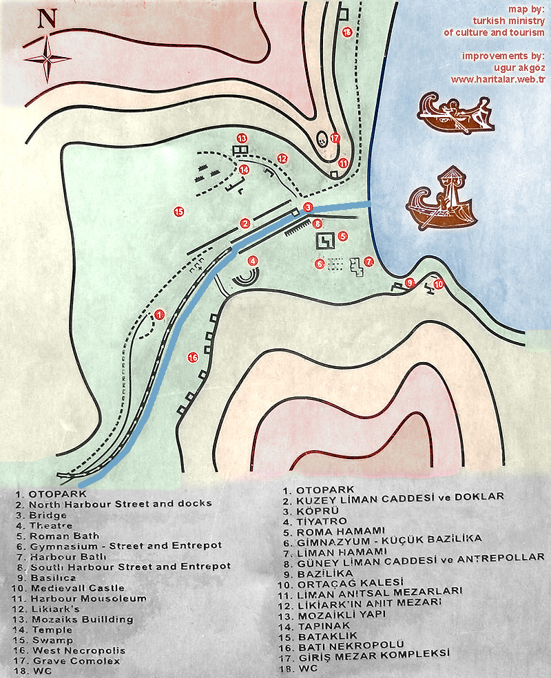
Olympos antik sehir haritasi / Map of the antique Olympos

Bu harita ve tarifler, Kültür ve Turizm Bakanligi'nin Olympos sit alani içerisindeki açik hava müzesinde yer almaktadir.
Benim tarafimdan fotoğraflanip, renklendirilmistir.


Olympos haritasi 
Kültür ve Turizm Bakanligi'na ait tabela

map of the antique Olympos
by the Ministry of Culture and Tourism 

colored and improvements by
renklendirme ve iyilestirmeler:
Ugur Akgöz / www.haritalar.web.tr


 description of the antique Olympos in english / türkçe

Olympos ismini kuzeyindeki 2375 metre yükseklige sahip Tahtali Dagi'ndan almistir. 
Antik ismi Uludag anlamina gelen Olymostur.

Olympos takes its name from the Tahtali Mountain, which is 2375 meter high and placed in the north.
The antique name is Olympos, which means Uludag.
 free counter


newer version map of the antique Olympos in english / türkçe

please download for detailed view
.
please download this picture for detailed view
 
newer description of the antique Olympos in english / türkçe

please download for more detailed view
.
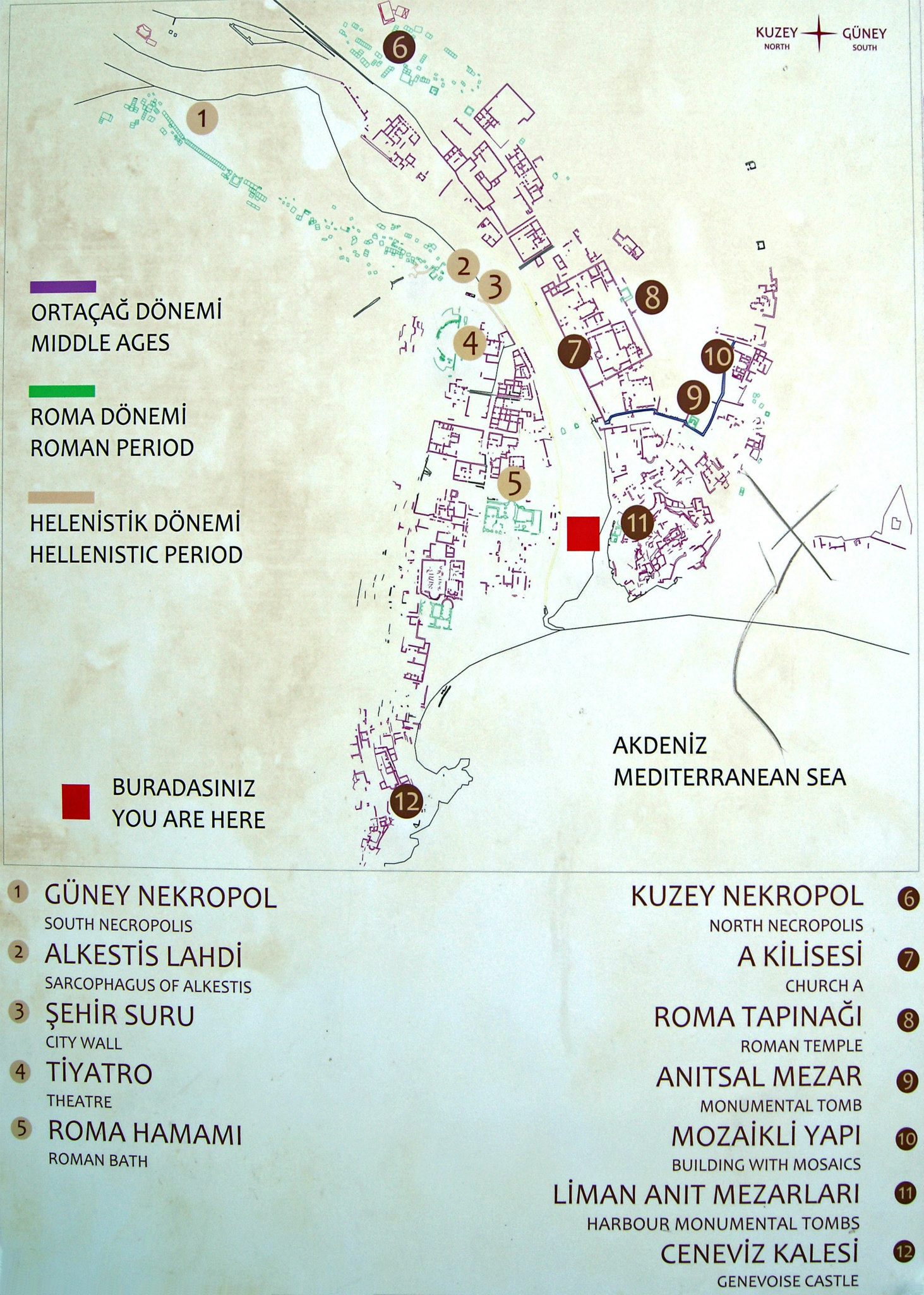
please download this picture for more detailed view
Antalya Olympos ayrintili uydu haritasi. Önce 'Karma' seçiniz, sonra çift tiklayip yaklastiriniz.

<< anasayfa / homepage     |    Olympos resimleri / more Olympos pictures >>